Geophysical expedition to the Namib completed
23.03.2022
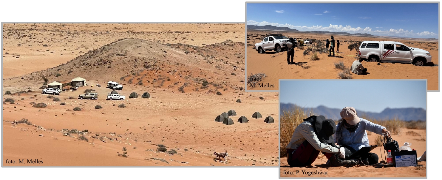
Without any major complications we successfully completed our 21 days geophysical survey at the Roter Kamm impact crater and the Aurus clay pan on 15 March (as part of the https://sfb1211.uni-koeln.de). The survey took us deep into the Sperrgebiet of the Namib desert, required us to shuttle food and water supplies regularly from the mining town Roshpinah located two hours off-road driving distance. With great support from the local community and the Sperrgebiet rangers we had our camp set up close to the Aurus mountains. Two existing metal rondavels protected our kitchen facilities and geophysical equipment from animals, extreme winds and dust storms, even sometimes from rain. 12 sleeping tents were set up around the camp site. A close by borehole with rather minor water quality provided us with sufficient usage water for washing and showering.
Besides beautiful night skies, magnificent desert sceneries with a variety of color spectacles we met plenty desert inhabitants - from small spiders, scorpions and snakes to many ostriches, herds of oryx antilopes, few springboks and the mostly night active hyenas and jackals. Every morning we could see the traces of hyenas and jackals around our equipment, which we left in the field overnight. Several seismic trigger cables and electromagnetic sensor lines suffered from curious and hungry mouths. For the past 100 years the Sperrgebiet remained untouched and the beautiful nature preserved. Ongoing negotiations will probably result in an opening of the Sperrgebiet as a national park for tourists. For this reason the park rangers allowed us only a few driving tracks and prohibited driving into the Roter Kamm. Consequently all geophysical measurements inside the crater had to be done with man power.
On the geophysical side - the Aurus clay pan could efficiently be covered by two long seismic and electromagnetic transects at extremely high resolution. Preliminary results show that the clay pan is larger than expected and visible from satellite images, since the periphery is covered by younger fluvial deposits. Clear seismic refraction traces with high p-wave velocities and electromagnetic data indicate bedrock already at depths of roughly 15-20 meters. The clay sediment record, recovered with a simple coring device down to four meters, will provide important information concerning past pluvial periods. Although access was difficult, we surveyed two electromagnetic transects across the Roter Kamm, of which one transect extended 10 km over the crater rim towards the Aurus mountains. First results are extremely convincing and showed a bowl shape basement resistor with a maximum depth of 350 meters at the crater center. But also some interesting internal layering is imaged within the upper 150 meters that need further analysis and an integration of seismics, magnetics and geological background for a concise understanding. Halftime of our survey we hosted 20 UNAM students for one night in our camp and gave an half day introductory tutorial to the project including a short geophysical field practice on EM and seismic methods.
All our team efforts and long term preparations were totally worth it - we return home with plenty of good data and rich experiences. A big thanks goes out to the complete team and all involved people.